|

|

|
| Link to traditional HTML menu for those who don't see any buttons above, or if those don't work | ||
Derivation of Scott County | ||
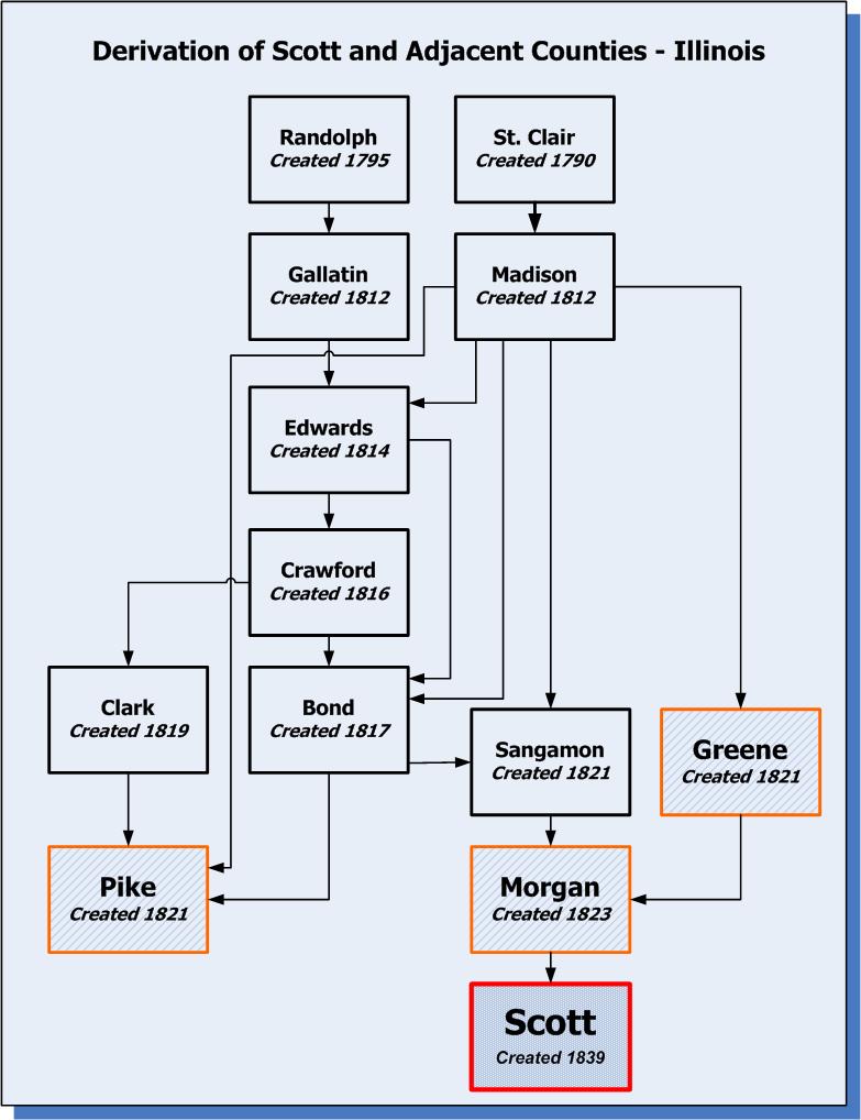
The following is a "map" of the derivation of Scott county and it's adjacent counties from their parent counties, sort of a pedigree chart for the counties. Below on this page you will see a graphical copy. A printable PDF copy is also available through this link: Taney and Adjacent County Missouri Derivation.pdf.
Here is a simple key to the map. Scott county is outlined in red and the text is the largest. Adjacent counties are outlined in orange, have a cross hatched background, and and have the next largest text. Other counties that contributed territory to Scott and it's neighbors are outlined in black and have the smallest text. Any records that relate to people or places in Scott county would be in the parent counties until the "created" date you see listed. Note that most of these county splits occurred before there was any significant population in Scott county. Also note that this area was part of the Northwest Territory until 1800. It then became part of Indiana Territory until 1809 when Illinois Territory was formed. Illinois became a state in 1818. If you detect any errors, or have any questions or suggestions about this diagram, feel free to contact the coordinator through the link below.

|
Note: Links to external web sites are provided as a convenience; they do not constitute an endorsement of any products, services or opinions you might find there. | |
| County Coordinator New Coordinator Needed |
Illinois State Coordinator Deb Haines |
|
Copyright 2005, 2010; This page was last modified 5 December 2009. Send any questions, suggestions, or comments to the Scott County Coordinator (Vacant at present). | |